-
Shipping Details
U.S. Domestic
Flat Rate Shipping
$3.50 per order (Standard)
$10.50 per order (Expedited)
International Shipping
You pay actual shipping cost.
No additional fees.
If the cost is higher than the estimate shown at checkout we will email you for approval before we charge your card.
Wholesale Customers
You pay actual shipping cost.
No additional fees. Actual cost is determined when your order is packed for shipment. -
Prefer to order by phone?
Order this product online or by phone
Call us now at (707) 822-9063
Mon-Friday 8am to 5pm PST
Description
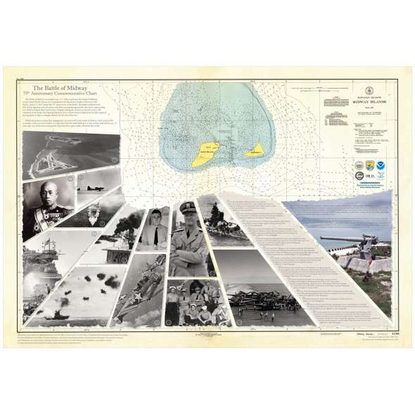
NOAA’s Office of Coast Survey and Office of National Marine Sanctuaries created a commemorative nautical chart for the Battle of Midway’s 75th anniversary. This nautical chart was first published in 1943, and the commemorative chart includes the original depth soundings surrounding the islands overlaid with historical photos from the battle.
The Battle of Midway was fought from June 3–7, 1942, at and around the island of Midway in the central Pacific Ocean. Today, it is considered to be the decisive battle of the war in the Pacific. Over the next few days, we will mark the 75th anniversary of the battle. The battle resulted in the loss of four Japanese aircraft carriers and their accompanying aircraft and crew, accounting for two-thirds of Japan’s fleet carrier force. Despite sinking the American aircraft carrier USS Yorktown during the battle, the Japanese Navy’s severe losses would never be fully replaced, forcing them to fight a strategic defense for the rest of the war. While the primary carrier fleet engagement occurred to the north of Midway Atoll, much of the secondary action originated from the atoll itself. Midway is a tiny, remote atoll which was, 75 years ago, one of the most strategically important few square miles of land in the world. On September 2, 1945, the Japanese officially surrendered to end WWII.
Designed to appear aged.
Details
Specifications
Reviews
No reviews found


