-
Shipping Details
 U.S. Domestic
Flat Rate Shipping
$3.50 per order (Standard)
$10.50 per order (Expedited)
 International Shipping
You pay actual shipping cost.
No additional fees.
If the cost is higher than the estimate shown at checkout we will email you for approval before we charge your card.
 Wholesale Customers
You pay actual shipping cost.
No additional fees. Actual cost is determined when your order is packed for shipment. -
Prefer to order by phone?
Order this product online or by phone
Call us now at (707) 822-9063
Mon-Friday 8am to 5pm PST

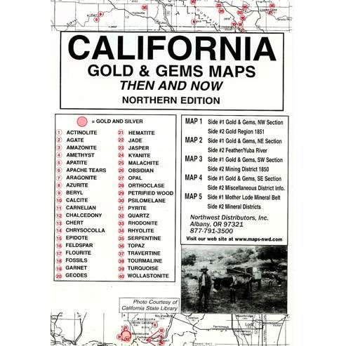
Description
This package, measuring 6.5″ x 9.5″, contains five maps printed on both sides . The very readable historical maps measure 17.5″ x 23″ when unfolded. Maps have been reproduced from authentic documents on file from archival sources — 100 years of reported gold and gems occurrences listed; red numbered guide shows 40 gem site locations. Package includes:
Map #1, side 1 is of the NW Section. Side 2 is a map of 1851 showing the gold regions
Map #2, side 1 is of the NE Section. Side 2 is a map of the Feather/Yuba River
Map #3, side 1 is of the SW Section. Side 2 is a map of 1850 mining district
Map #4, side 1 is of the SE section. Side 2 contains miscellaneous district info
Map #5 is a map of the Mother Lode Mineral Belt. Side 2 is map of the mineral districts
Details
Specifications
Reviews
No reviews found