-
Shipping Details
U.S. Domestic
Flat Rate Shipping
$3.50 per order (Standard)
$10.50 per order (Expedited)
International Shipping
You pay actual shipping cost.
No additional fees.
If the cost is higher than the estimate shown at checkout we will email you for approval before we charge your card.
Wholesale Customers
You pay actual shipping cost.
No additional fees. Actual cost is determined when your order is packed for shipment. -
Prefer to order by phone?
Order this product online or by phone
Call us now at (707) 822-9063
Mon-Friday 8am to 5pm PST
Description
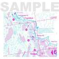
COLUMBIA RIVER, LOWER - Bonneville Dam to Pacific Ocean, including Portland, Oregon
10 foot underwater depth contours
Suggested Fish Locations + Fishing Strategy
Multiple GPS coordinates provided.
Fish-n-Map Company's GPS coordinates are attached to various structural elements which have the potential of holding fish - depending on the season, water elevation, etc. These GPS coordinates are available in gpx format for downloading into chart plotters, fish finders and hand held devices. See "Columbia River, Lower - gpx formatted gps coordinates" if interested.
MADE IN THE U.S.A.
Details
Specifications
Product Type :
Book
Book Type:
Field Identification Guide
Dimensions (IN):
9 x 4.2 Folded
Supplier/Publisher:
Fish 'n' Maps
ISBN:
761428092090
Format:
Folding Waterproof Map
Reviews
No reviews found


