-
Shipping Details
U.S. Domestic
Flat Rate Shipping
$3.50 per order (Standard)
$10.50 per order (Expedited)
International Shipping
You pay actual shipping cost.
No additional fees.
If the cost is higher than the estimate shown at checkout we will email you for approval before we charge your card.
Wholesale Customers
You pay actual shipping cost.
No additional fees. Actual cost is determined when your order is packed for shipment. -
Prefer to order by phone?
Order this product online or by phone
Call us now at (707) 822-9063
Mon-Friday 8am to 5pm PST
Description
Features
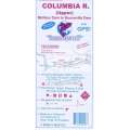
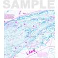
10 foot underwater depth contours
Underwater features identified including submerged roadbeds, railroad tracks and railroad beds, wrecks
Underwater bottom conditions identified: sand, rocky, mud
Latitude and longitude grids with over 100 GPS coordinates identified
GPS Quick Scaler
Numerous Fish Locations shown throughout chart
Boat ramps, roads, marinas and boat moorage facilities identified
Waterproof and Tear-resistant plastic, folds to 9”x4”, unfolds to 3’x2’, 2-sided chart
Made by a Fisherman for Fishermen and Other Water Enthusiasts
Details
Specifications
Reviews
No reviews found


