-
Shipping Details
U.S. Domestic
Flat Rate Shipping
$3.50 per order (Standard)
$10.50 per order (Expedited)
International Shipping
You pay actual shipping cost.
No additional fees.
If the cost is higher than the estimate shown at checkout we will email you for approval before we charge your card.
Wholesale Customers
You pay actual shipping cost.
No additional fees. Actual cost is determined when your order is packed for shipment. -
Prefer to order by phone?
Order this product online or by phone
Call us now at (707) 822-9063
Mon-Friday 8am to 5pm PST
Description
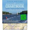
A perfect navigational backup for that fluky chartplotter or iPadNavigating the Intracoastal Waterway from Virginia to Florida, or vice versa, is certainly possible with only a chartplotter, but prudent mariners like you know it's smart to have a back-up. Intracoastal Waterway Chartbook Norfolk to Miami is handy, up-to-date, and full of ALL the information you need to pass safely under bridges and anchor safely for the nightInside you'll find:$500 worth of NOAA Charts for the 1,090-mile Intracoastal Waterway, as well as charts for all major Atlantic inletsPreferred route is clearly marked in magenta for the entire routeStatute miles noted in five-mile increments in the marginsMarinas marked on charts with phone numbersBridge, lock, and anchorage locations called outPlace-name index for quick loop-upNew marina listings helps locate places to refuel or reconnect
Details
Specifications
Product Type :
Book
Book Type:
Paperback
Dimensions (IN):
11.7 x 8.5 x 1.2
Pages:
304 pages
Author:
John & Leslie Kettlewell
Supplier/Publisher:
McGraw Hill/ International Marine
Published Date:
2012
ISBN:
9780071803908
Format:
Spiral-Bound
Reviews
No reviews found


