
-
Shipping Details
 U.S. Domestic
Flat Rate Shipping
$3.50 per order (Standard)
$10.50 per order (Expedited)
 International Shipping
You pay actual shipping cost.
No additional fees.
If the cost is higher than the estimate shown at checkout we will email you for approval before we charge your card.
 Wholesale Customers
You pay actual shipping cost.
No additional fees. Actual cost is determined when your order is packed for shipment. -
Prefer to order by phone?
Order this product online or by phone
Call us now at (707) 822-9063
Mon-Friday 8am to 5pm PST

Description
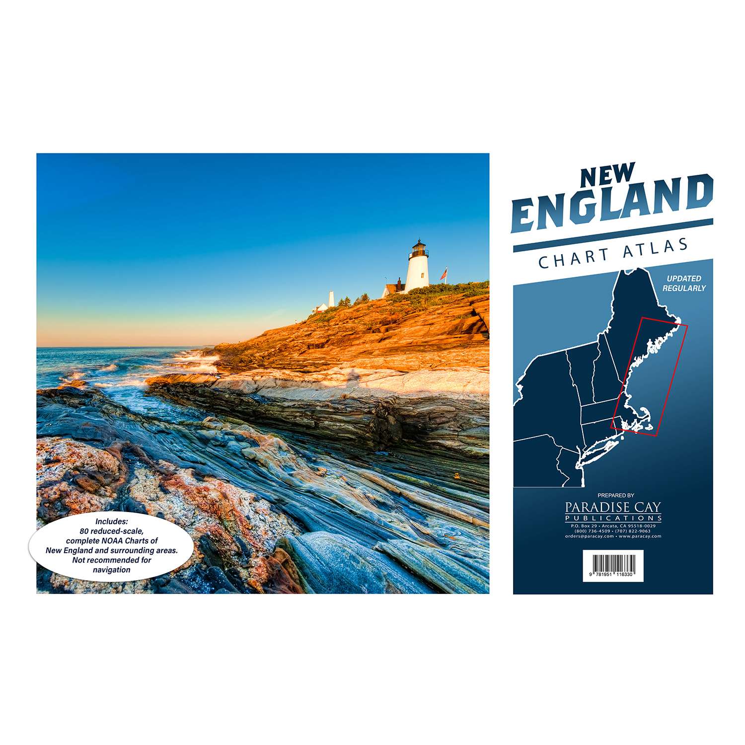
80 reduced-scale complete NOAA charts of the New England area. Spiral-bound in a large format (12x18") booklet. Printed on high-quality paper and updated regularly.
Not recommended for navigation, but handy for reference and planning.
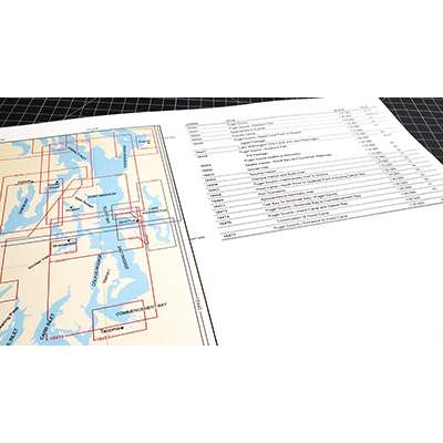
Each chart atlas includes a map key at the beginning which helps you locate the charts inside.
- Charts are organized numerically by chart number
- Easy-to-read map grid clearly indicates each chart's area of coverage
Includes the following NOAA charts:
- 13205
- 13209
- 13211
- 13212
- 13213
- 13214
- 13215
- 13217
- 13218
- 13221
- 13223
- 13224
- 13225
- 13226
- 13227
- 13228
- 13229
- 13230
- 13232
- 13233
- 13235
- 13236
- 13237
- 13238
- 13241
- 13242
- 13244
- 13246
- 13248
- 13249
- 13250
- 13251
- 13253
- 13260
- 13267
- 13269
- 13270
- 13272
- 13274
- 13275
- 13276
- 13278
- 13279
- 13281
- 13282
- 13283
- 13285
- 13286
- 13287
- 13288
- 13290
- 13292
- 13293
- 13295
- 13296
- 13297
- 13298
- 13301
- 13302
- 13303
- 13305
- 13307
- 13308
- 13309
- 13312
- 13313
- 13315
- 13316
- 13318
- 13321
- 13322
- 13323
- 13324
- 13325
- 13326
- 13392
- 13394
- 13396
- 13398
Our chart atlases cover all of the popular boating areas across the United States. We include all of the full sized NOAA charts from each area and scale them down to fit the 12 x 18” format. Spiral binding makes it easy to use these atlases when reviewing an area. We use only high-quality coated paper and print on state-of-the-art printers. We laminate each cover for durability. Each atlas begins with key to the charts and a table of contents. Charts are arranged by chart number. In some cases we split a single chart into a two-page spread, but most charts are presented one per-page. Each atlas is updated at intervals throughout the year. These books are designed as a useful reference and are not recommended for navigation purposes. However, these atlases are a great value to boaters and armchair sailors alike.
Details
Specifications
Reviews
No reviews found