

-
Shipping Details
 U.S. Domestic
Flat Rate Shipping
$3.50 per order (Standard)
$10.50 per order (Expedited)
 International Shipping
You pay actual shipping cost.
No additional fees.
If the cost is higher than the estimate shown at checkout we will email you for approval before we charge your card.
 Wholesale Customers
You pay actual shipping cost.
No additional fees. Actual cost is determined when your order is packed for shipment. -
Prefer to order by phone?
Order this product online or by phone
Call us now at (707) 822-9063
Mon-Friday 8am to 5pm PST

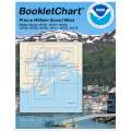
Description
A compilation of NOAA BookletCharts that cover the western area of the Prince William Sound.
- Spiral-Bound
- Laminated Covers
Includes the following BookletCharts:
- 16700
- 16701 (HISTORICAL CHART, NO LONGER UPDATED BY NOAA)
- 16702 (HISTORICAL CHART, NO LONGER UPDATED BY NOAA)
- 16704 (HISTORICAL CHART, NO LONGER UPDATED BY NOAA)
- 16705
- 16711 (HISTORICAL CHART, NO LONGER UPDATED BY NOAA)
- 16712
- 16713 (HISTORICAL CHART, NO LONGER UPDATED BY NOAA)
Details
Specifications
Product Type :
Chart
Nautical Chart Type:
NOAA Charts
Nautical Chart Format:
8.5 x 11" Booklet Charts
Dimensions (IN):
8.5 x 11
Pages:
154 pages
Supplier/Publisher:
Paradise Cay Publications
Published Date:
2021
Date Added:
July 2021
Format:
Spiral-Bound
Reviews
No reviews found