-
Shipping Details
U.S. Domestic
Flat Rate Shipping
$3.50 per order (Standard)
$10.50 per order (Expedited)
International Shipping
You pay actual shipping cost.
No additional fees.
If the cost is higher than the estimate shown at checkout we will email you for approval before we charge your card.
Wholesale Customers
You pay actual shipping cost.
No additional fees. Actual cost is determined when your order is packed for shipment. -
Prefer to order by phone?
Order this product online or by phone
Call us now at (707) 822-9063
Mon-Friday 8am to 5pm PST
Description
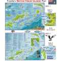
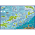
Waterproof map ideal for scuba divers, snorkelers, sailors and tourists. Includes paved roads, dirt roads, overnight/day anchorage, points of interest, lodging/places to stop, water depth contours (meters), soundings, GPS coordinates, sailing routes, scuba sites, snorkel sites, dive shops. Includes a list of the marine life around the islands, inset map of the wreck RMS Rhone, list of dive operators, charter boats.
Details
Specifications
Product Type :
Map
Book Type:
Map
Dimensions (IN):
4.5 x 9
Supplier/Publisher:
Franko Maps
Published Date:
2009
ISBN:
9781931494168
Date Added:
December 2017
Format:
Map
Reviews
No reviews found


