
-
Shipping Details
 U.S. Domestic
Flat Rate Shipping
$3.50 per order (Standard)
$10.50 per order (Expedited)
 International Shipping
You pay actual shipping cost.
No additional fees.
If the cost is higher than the estimate shown at checkout we will email you for approval before we charge your card.
 Wholesale Customers
You pay actual shipping cost.
No additional fees. Actual cost is determined when your order is packed for shipment. -
Prefer to order by phone?
Order this product online or by phone
Call us now at (707) 822-9063
Mon-Friday 8am to 5pm PST

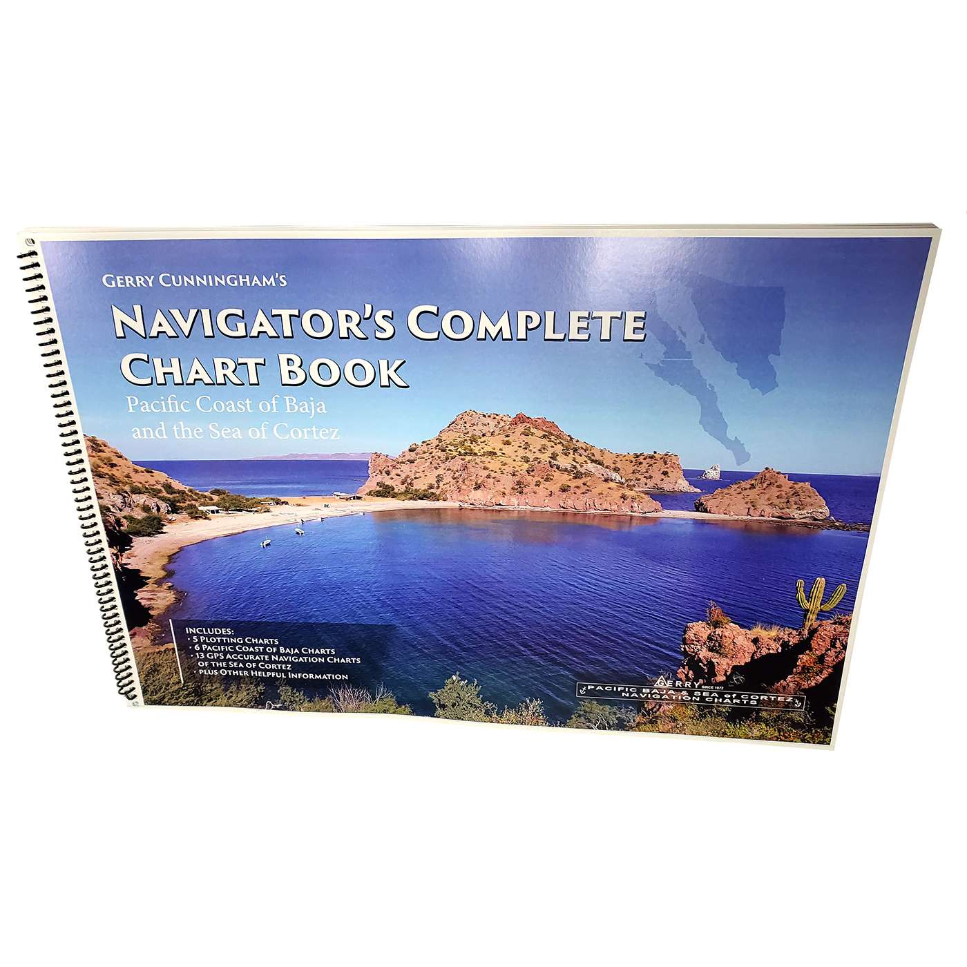
Description
The complete chart book includes all of the chart content previously available from Gerry Charts covering the region of Baja and The Sea of Cortez.
The charts in this book have been scaled down proportionately to fit the page and are intended as a useful reference.
Not recommended for navigation or as a replacement for current nautical charts.
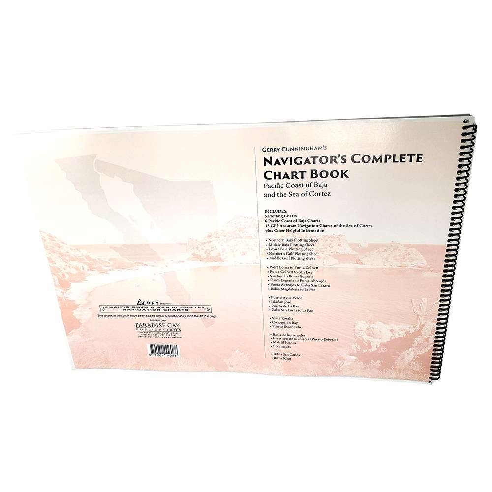
NCLUDES: 5 Plotting Charts, 7 Pacific Coast of Baja Charts, 13 GPS Accurate Navigation Charts of the Sea of Cortez, Three current NGA charts, plus Other Helpful Information • Northern Baja Plotting Sheet • Middle Baja Plotting Sheet • Lower Baja Plotting Sheet • Northern Gulf Plotting Sheet • Middle Gulf Plotting Sheet • Point Loma to Punta Colnett • Punta Colnett to San Jose • San Jose to Punta Eugenia • Punta Eugenia to Punta Abreojos • Punta Abreojos to Cabo San Lazaro • Bahia Magdalena to La Paz • Puerto Agua Verde • Isla San Jose • Puerto de La Paz • Cabo San Lucas to La Paz • Santa Rosalia • Conception Bay • Puerto Escondido • Bahia de los Angeles • Isla Angel de la Guarda (Puerto Refugio) • Midriff Islands • Encantades • Bahia San Carlos • Bahia Kino
Details
Specifications
Reviews
No reviews found