Filter Search Results

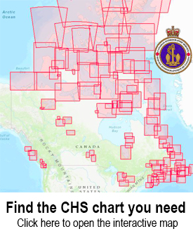
Use the CHS Chart Index

Displays the geographical extent of products produced by the Canadian Hydrographic Service,
Canadian Hydrographic Charts

The Canadian Hydrographic Service distributes nautical charts for navigation through a dealer network that serves Canada and the entire world. These are paper charts covering all 3 of Canada’s coastlines plus major lakes and inland waterways.


You will need the number of your chart when ordering.

To find the chart that you need, you can search the chart catalogs or interactive maps.

  • Chart Index – an interactive web map showing both digital and paper chart coverage areas
  • List of Charts – Paper charts
1 2 3 4 5 6
CHS Chart 4416: Havre de Gaspé
CAN4416

$24.95
CHS Chart 3794: Stewart
CAN3794

$18.95
CHS Chart 3986: Browning Entrance
CAN3986

$24.95
CHS Chart 3893: Masset Inlet
CAN3893

$24.95
CHS Chart 3052: Okanagan Lake
CAN3052

$22.95
CHS Chart 3948: Gardner Canal
CAN3948

$24.95
CHS Chart 4518: Ariege Bay
CAN4518

$24.95
CHS Chart 3857: Louscoone Inlet
CAN3857

$24.95
CHS Chart 7310: Jones Sound
CAN7310

$24.95
CHS Chart 3964: Tuck Inlet
CAN3964

$18.95
CHS Chart 3668: Alberni Inlet
CAN3668

$24.95
CHS Chart 5059: Saglek Bay
CAN5059

$24.95
CHS Chart 4521: Baie Verte
CAN4521

$24.95
CHS Chart 4653: Bay of Islands
CAN4653

$24.95
CHS Chart 4659: Port au Port
CAN4659

$24.95
CHS Chart 4722: Terrington Basin
CAN4722

$24.95
CHS Chart 7371: Alexandra Fiord
CAN7371

$24.95
CHS Chart 3863: Port Chanal
CAN3863

$18.95
CHS Chart 7511: Resolute Passage
CAN7511

$24.95
CHS Chart 7181: Durban Harbour
CAN7181

$24.95
CHS Chart 6269: Wanipigow River
CAN6269

$18.95
CHS Chart 3685: Tofino
CAN3685

$18.95
CHS Chart 7578: Pelly Bay
CAN7578

$24.95
CHS Chart 7784: Victoria Strait
CAN7784

$24.95
CHS Chart 3680: Brooks Bay
CAN3680

$24.95
CHS Chart 5440: Wager Bay
CAN5440

$24.95
CHS Chart 3963: Work Channel
CAN3963

$24.95
1 2 3 4 5 6