Filter Search Results

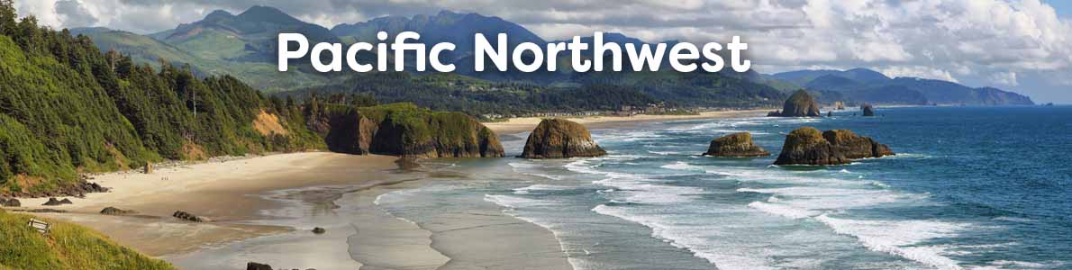
Pacific Northwest / Pacific Coast

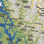
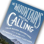
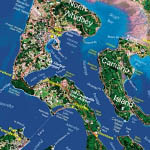
The Pacific Northwest offers some of the world's best camping, fishing, hiking, and beachcombing in the world. Whether you are hiking through Redwood National Forest, skiing/snowboarding at Mt. Hood, Bachelor, Shasta, Tahoe...the list goes on.

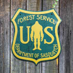
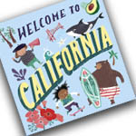
Get the most out of your journey through the PNW with our collection of guides, maps, tools, and maybe some fun activities for the kids. We offer an extensive and ever-expanding catalog of books and gifts related to the Pacific Northwest region of the United States including Alaska, Washington, Oregon, and California. Wholesale inquiries welcome.

$3.00  
2-Sided Laminated Card, 5.5 x 8.5, 9781601904515
A handy guide! Side one is a beautiful mini-map of the Lake Tahoe area with land and water relief and points of interest. Side two is an illustrated guide to the fish found in the lake. The card is 6" x 9" and features rigid lamination and a hole for lanyard.

$34.95  
Spiral-Bound, 85 pages, 18.5 x 16.5, 761428040015
UPDATED MAY OF 2018  Overall atlas size increased to 18 1/2" x 13 1/2" Most lakes are now shown in 3 color Lakes with longitude and latitude grids are scaled in NAD 83 Fish Habitat Areas are identified on most lakes including submerged rock rubble reefs, submerged vegetation, shoreline...

$9.95  
Laminated 2-Sided, 7 x 11.5, 9781888538922
Laminated 2-sided

$9.95  
C6, 2.75 x 2.6
Laser-cut steel, stone tumbled and finished with Squatch Metalworks proprietary distressed metal patina treatment. Clear coated with durable automotive clear-coat. Backed with a Rare Earth magnet. DESIGNED AND MANUFACTURED IN THE USA.

$14.95  
Folding Waterproof Map, 9 x 4.2 Folded, 761428092090
COLUMBIA RIVER, LOWER - Bonneville Dam to Pacific Ocean, including Portland, Oregon 10 foot underwater depth contours Suggested Fish Locations + Fishing Strategy Multiple GPS coordinates provided. Fish-n-Map Company's GPS coordinates are attached to various structural elements which...

$19.95  
Paperback, KEN AXT, 88 pages, 8.5 x 11, 9781571885272
Clamming is a rapidly growing hobby in the Pacific Northwest. It's great fun for all ages, you don't need a boat or expensive tackle, and chances are there is a location near you. If you are new to clamming, you'll find simple instructions that will have you harvesting clams in minutes. If...

$14.95  
Folding Waterproof Map, 9 x 4.2 Folded, 761428091239
Contours:  5 meter Scale:  1:100,000 GPS Data:  Yes Water Type:  Salt Region/State(s):  Washington,Canada UPC:  761428 091239

$10.95  
Folding Waterproof Map, 9 x 4.2 Folded, 761428 091017
Features: 20 foot underwater depth contours Underwater features identified including wrecks, weedbeds, artificial reefs, dredged channels Latitude and Longitude Grids with Over 90 GPS Coordinates Identified Numerous Fish Locations presented throughout chart Fishing Strategies (Ideas) Artificial...

$10.95  
Folding Waterproof Map, 9 x 4.2 Folded, 761428101037
Contours:  5 meter Scale:  1:56,300 GPS Data:  Yes Water Type:  Salt Region/State(s):  Canada Price:  $10.95 UPC:  761428 101037

$10.95  
Folding Waterproof Map, 9 x 4.2 Folded, 761428091246
Featuring:  10 foot and 5 meter underwater depth contours for easy structure identification, navigational aids identified including buoys, lights, platforms, longitude and latitude, fishing locations including numerous GPS coordinates, boat ramps and marina facilities identified.  Printed on...

$14.95  
Waterproof Map, 4 x 9 (Folded), 761428082732
Waterproof map   Contours:  20' Scale:  1:28,500 / 1:12,600 GPS Data:  No Water Type:  Fresh

$9.95  
Waterproof Map, 4 x 9 (Folded), 761428082633
Waterproof Map   Contours:  20' Scale:  1:23,500 GPS Data:  Yes Water Type:  Fresh

$14.95  
Folding Waterproof Map, 9 x 4.2 Folded, 761428092120
Scale:  1:30,000 GPS Data:  Yes Water Type:  Fresh Region/State(s):  Oregon Price:  $9.95 UPC:  761428 092120

$24.95  
Paperback, Ray Rychnovsky and Esther Poleo, 48 pages, 15 x 11.2 x 0.2, 9781571885180
Finally, the ultimate book for Northern California anglers! Detailed maps covering over 1000 miles of river! Included for each river are the best seasons, species, available illustrated fishing methods (both fly and gear), best flies and best gear for individual rivers and species, fly hatches,...

$9.95  
Folding Waterproof Map, 9 x 4.2 Folded, 761428092045
Contours:  5' Scale:  1:26,000 / 1:35,700 GPS Data:  Yes Water Type:  Fresh Region/State(s):  Washington Price:  $9.95 UPC:  761428 092045

$24.95  
Paperback, Sean Godwin, Martin Krkosek, 160 pages, 5.5 x 8.5, 9781774511343
Pacific salmon are of immense cultural, ecological and economic importance to the west coast of North America. They are the most commonly seen fish on the western side of North America but identifying among the seven species is difficult for most of their life stages. Two salmon researchers have...

$9.95  
Map, 4 x 9 (Folded)
WATERPROOF MAP

$14.95  
Folding Waterproof Map, 9 x 4.2 Folded, 761428101013
Contours:  5 meter Scale:  1:100,000 GPS Data:  Yes Water Type:  Salt Region/State(s):  Canada Price:  $10.95 UPC:  761428 101013

$9.95  
Map, 4 x 9 (Folded)
WATERPROOF MAP

$14.95  
Folding Waterproof Map, 9 x 4.2 Folded, 761428092083
Features 10 foot underwater depth contours Underwater features identified including submerged roadbeds, railroad tracks and railroad beds, wrecks Underwater bottom conditions identified: sand, rocky, mud Latitude and longitude grids with over 100 GPS coordinates identified GPS Quick Scaler...

$10.95  
Folding Map, 9 x 4.2 Folded, 761428 091024
FEATURES: 20 foot depth contours Underwater features identified including wrecks, weedbeds, artificial reefs, underwater bottom conditions, dredged channels Latitude and Longitude Grids with Over 100 GPS Coordinates Identified Numerous Fish Locations presented throughout chart Fishing...

$9.95  
Laminated 2-Sided, 7 x 11.5, 9781888538199
This is a laminated field guide with illustrations of 86 Pacific coast sport fish. It can be used to identify sportfish from Southern California to Northern Ecuador. Each species is identified by their English, Spanish and Latin Names.

$9.95  
Map, 4 x 9 (Folded)
WATERPROOF MAP

$39.99  
John Martinis, 172 pages, 9781934707814
This instantly best selling guide to fishing in Puget Sound, Strait of Juan de Fuca and the San Juan Islands features all the best advice you need to develop successful technique for landing salmon, halibut, rockfish, steelhead, crab and shrimp. Everett Herald outdoor writer Wayne Kruse writes,...