


-
Shipping Details
 U.S. Domestic
Flat Rate Shipping
$3.50 per order (Standard)
$10.50 per order (Expedited)
 International Shipping
You pay actual shipping cost.
No additional fees.
If the cost is higher than the estimate shown at checkout we will email you for approval before we charge your card.
 Wholesale Customers
You pay actual shipping cost.
No additional fees. Actual cost is determined when your order is packed for shipment. -
Prefer to order by phone?
Order this product online or by phone
Call us now at (707) 822-9063
Mon-Friday 8am to 5pm PST -
ABOUT WHOLESALE DISCOUNTS ON THIS ITEM
The wholesale discount on this item may display incorrectly when you order.
- We will correct this when processing you order.
- The correct discount is 45% off the retail price.
- Please contact our office with any questions.

Description
-
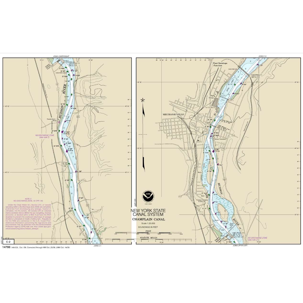
This chart has been canceled by NOAA as of 12/04/2024 and is no longer maintained with updated data.
- Chart is NOT up-to-date since it is out of continual maintenance ·
- Chart is NOT updated daily and being printed on demand will NOT provide the latest published data possible
- This is NOT the most fully corrected, up-to-date U.S. charts available
- Chart is NOT updated weekly and does NOT include all of the latest Notice to Mariners corrections.
- The data from which this POD chart is produced is NOT certified by NOAA for navigation use, and is NOT correct to the date of printing
- Future Notice to Mariners corrections will NOT be applied to this chart
- This product will NOT meet U. S. and international carriage requirements for commercial vessels defined in SOLAS Chapter V Regulation 19.2.1.373
- The chart is NOT a U. S. Coast Guard approved product.
Details
Specifications
Product Type :
Chart
Nautical Chart Type:
NOAA Charts
Nautical Chart Format:
12 x 18" NOAA Chart Booklets
Dimensions (IN):
12 x 18
Format:
Spiral Bound Paper
Reviews
No reviews found